Sandakphu Phalut Trek

Sandakphu Phalut Trek
Duration 7 Days / 6 Nights
Location Darjeeling, West Bengal
Group Size 2-12 People
Difficulty Easy
Starting From ₹16,500 Per person

Sandakphu is the highest point in West Bengal. It stands at 3,636 metres. The Sandakphu Phalut trek is the best-known route to reach it. This 7-day trek package runs along the Singalila Ridge, from Manebhanjan to Srikhola. On the way, you pass through rhododendron forests, small Nepali villages, and open alpine meadows. The trek ends at Phalut, the second-highest point on the ridge, at 3,600 metres.

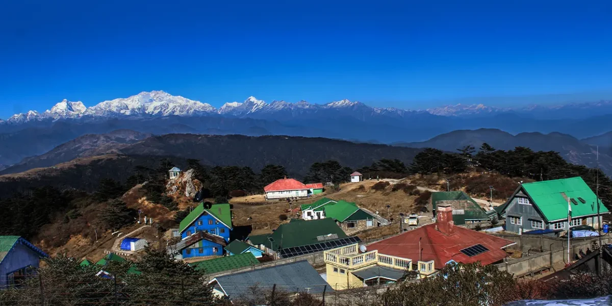
The view is what sets this trek apart. On a clear day, Sandakphu gives you an open look at four of the world’s five highest peaks: Everest, Kanchenjunga, Lhotse, and Makalu. No other easy trek in India offers this. Look west and you see the Everest range above the clouds. Look east and Kanchenjunga fills the sky.

Kanchenjunga is the real star here. From Sandakphu, Sabargram, and Phalut, its peaks line up to form the shape of a giant sleeping figure. Locals call this the Sleeping Buddha. At sunrise, the first light turns the snow from deep blue to gold across the whole range. Many trekkers call it the best mountain sunrise they have ever seen.

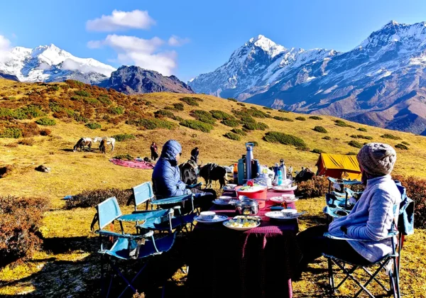
This trek does not need tents or heavy gear, unlike tougher Sikkim treks such as Goecha La. You sleep in warm teahouses and homestays every night, run by local Nepali, Sherpa, and Lepcha families. Along with its easy-to-moderate grade, this makes the trek a good fit for first-time trekkers, older trekkers, and photographers who want big views without a hard climb.

The full route covers about 97 km over 7 days. It runs through Singalila National Park, home to the rare red panda. The trail also crosses the India-Nepal border many times a day, since it follows the ridge that divides the two countries. No visa is needed for these local crossings.

Best Time to Trek Sandakphu and Phalut

Spring (March to May): Rhododendrons bloom across the ridge in red, pink, and white. Days are mild at the lower camps, between 7°C and 17°C. Nights near Sandakphu stay close to freezing. Mist can build up by afternoon in April, so aim for early morning for the clearest peak views.

Autumn (October to November): This is the best season for the Sandakphu Phalut trek. The air is clean after the monsoon, and skies stay clear. The Sleeping Buddha and the Everest range show up in sharp, unbroken detail. Days range from 0°C to 12°C, and nights turn cold by late November. This is peak season, so book your trek package early.

Winter (December to February): Good for trekkers who want snow, quiet trails, and clear night skies for stargazing. Snow often covers the ridge by late December. Nights can drop to -4°C or lower. A warm down jacket, a -10°C sleeping bag, and microspikes are a must.

Monsoon (mid-June to mid-September): Singalila National Park stays closed during this time. Trekking is not allowed. This gives the forest and its wildlife, including the red panda, time to recover.
Day-by-Day Itinerary

1 Day

Arrival at Manebhanjan

Altitude: 2,134m | Drive: 4 to 5 hours from NJP or Bagdogra

Your trek begins with a scenic drive from New Jalpaiguri or Bagdogra. The road passes Darjeeling's tea estates, Mirik Lake, and pine forests, and ends at the border town of Manebhanjan. The rest of the day is for settling in. You will finish permit paperwork at the forest office and do a final gear check with your trek leader. Stay overnight in a homestay, with a full briefing on the days ahead.

2 Day

Manebhanjan to Tumling

Distance: 11 km | Duration: 6 to 7 hours | Altitude gained to: 2,957m

The trek starts with a steady climb through Chitrey and Lamaydhura. Next comes Meghma, a name that means "mother of clouds" in Nepali. You will register at the SSB border post here, since the trail now runs along the international border. The day ends at Tumling, a small village that sits fully inside Nepal. On a clear evening, this is your first view of the Sleeping Buddha, lit gold in the last light. Overnight in a teahouse.

3 Day

Tumling to Kalapokhri

Distance: 14 to 15 km | Duration: 6 to 7 hours | Altitude gained to: 3,170m

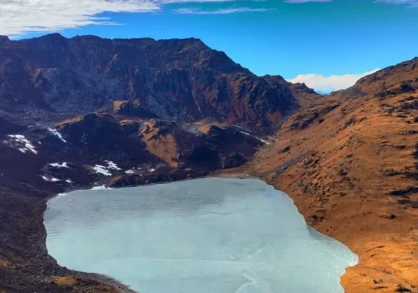
Past Tumling, the trail enters the core zone of Singalila National Park. This is one of the few places on earth where you might spot a wild red panda. The path drops through thick bamboo and rhododendron forest to Gairibas, a good rest stop, then climbs steeply to Kaiyakatta. The day ends at Kalapokhri, a sacred black lake said to never freeze, even in winter. Hundreds of prayer flags ring its banks. Overnight in a teahouse.

4 Day

Kalapokhri to Sandakphu

Distance: 6 to 6.5 km | Duration: 3 to 4 hours | Altitude gained to: 3,636m

Short in distance, but the toughest climb of the trek. After a gentle walk to Bikheybhanjyang, the trail turns sharply uphill for the final 4 km to the summit. It is worth every step. From Sandakphu, you get a full 180-degree view of both the Everest and Kanchenjunga ranges at once. No other easy trek in India offers this. Wind picks up fast on the open summit, so keep your down jacket close even in the afternoon. Overnight at Sandakphu.

5 Day

Sandakphu to Phalut via Sabargram

Distance: 21 km | Duration: 7 to 9 hours | Altitude: Stays above 3,500m all day

This is the heart of the Sandakphu Phalut trek, and the part most casual visitors skip. The road ends here, and the trail turns into a long, open ridge walk across wide alpine meadows. Everest stays on your left and Kanchenjunga on your right for most of the day. Sabargram is the only rest point along the way. Phalut, a Lepcha word for "barren peak," gives an even closer view of Kanchenjunga than Sandakphu does. Stay here is basic, in a government trekkers' hut, so keep your expectations simple. Overnight at Phalut.

6 Day

Phalut to Gorkhey

Distance: 15 km | Duration: 5 to 6 hours | Altitude lost to: 2,400m

A long, knee-testing descent through thick pine, oak, chestnut, and hemlock forest. The change is sharp. Within hours, you drop from a bare alpine ridge into warm, green forest. Gorkhey is a pretty little farming village on the banks of the Gorkhey Khola river, which also marks the border between West Bengal and Sikkim. Its homestays are known for their warmth, and this is a good night to rest after the long ridge walk. Overnight in a homestay.

7 Day

Gorkhey to Srikhola and Departure

Distance: 12 to 15 km | Duration: 4 to 5 hours | Altitude lost to: 1,900m

The final day is an easy, pleasant walk through terraced potato and pea fields, small hamlets, and river valleys. The trek ends at the hanging wooden bridge in Srikhola. From here, your vehicle takes you back to NJP or Bagdogra, a drive of 5 to 7 hours. This closes out your Sandakphu Phalut trek.

Looking for a shorter option? Ask us about our 5-Day Sandakphu-only itinerary, which skips the Phalut ridge walk and exits through Gurdum.

What's Included

  • All permits and forest entry fees for Singalila National Park
  • Trekkers' Registration Card, required by the SSB for border tracking
  • Mandatory local trekking guide, as per the 2023 regulation for the Sandakphu Phalut trek route
  • Accommodation for 6 nights in teahouses and homestays on twin/triple sharing
  • All meals during the trek, from dinner on Day 1 to breakfast on Day 7
  • First aid kit, pulse oximeter, and emergency oxygen cylinder carried by the trek leader
  • Camera fee for still photography, where applicable
  • Basic route support: SSB checkpost registrations, forest department paperwork, and daily briefings

What's Excluded

  • Transport to and from Manebhanjan / Srikhola (NJP or Bagdogra pickup and drop can be arranged as an add-on)
  • Porter or backpack offloading charges (approximately ₹3,000 to ₹4,000 for the full trek, available on request)
  • Personal trekking gear such as sleeping bags, trekking poles, and down jackets, if you don't already own them (rental available on request)
  • Personal expenses: bottled water, snacks, hot water for washing, and mobile charging at teahouses
  • Tips for your guide and porters
  • Travel and medical insurance
  • Video camera fee, if applicable
  • Any cost arising from itinerary changes due to weather, landslides, health emergencies, or government restrictions
  • GST and other applicable government taxes

Tour Location

No reviews yet. Be the first to share your experience after travelling with us!

Share Your Experience

Completed this tour or trek with us? We would love to hear about your journey.

Not shown publicly

Rate Your Experience

Overall Experience *
Service Quality
Guide & Team
Value for Money

Frequently Asked Questions

It is graded Easy to Moderate. You will walk 9 to 21 km a day on hilly terrain, with one steep climb on Day 4. Normal fitness is enough. You do not need any climbing skills.

October and November give the clearest mountain views. March to May is best for rhododendron blooms. December to February suits trekkers who want snow and quiet trails. The park stays shut from mid-June to mid-September for the monsoon.

Yes. You need a Singalila National Park permit and a Trekkers' Registration Card. Both are part of your trek package and are arranged at Manebhanjan.

Yes. Since 2023, a local guide is required for everyone on this route, even solo trekkers. Your package already includes this guide.

Network is weak at best. Jio and Airtel usually stop working past Tumling. BSNL and Nepali networks sometimes catch a signal on open ridges. Plan for a mostly offline week.

No. There are no ATMs on the trail. Carry all the cash you need from Siliguri, Darjeeling, or Manebhanjan before you start.

Sandakphu, at 3,636m, is the highest point. Since sleeping altitudes stay below 3,500m, the risk of serious altitude sickness is lower than on treks above 4,000m. Mild symptoms like headache or tiredness can still happen.

Yes. This is one of the more beginner-friendly Himalayan treks in India. The altitude is lower, you sleep in teahouses, and the daily distances are moderate. A few weeks of walking or jogging practice before the trek helps a lot.

Dress in layers. On top: a base layer, fleece, down jacket, and windproof shell. On the bottom: a base layer, trekking pants, and rain pants. Add high-ankle waterproof boots, a headlamp, trekking poles, and a reusable water bottle. Winter trekkers also need a -10°C sleeping bag and microspikes.